Assessor Property Information
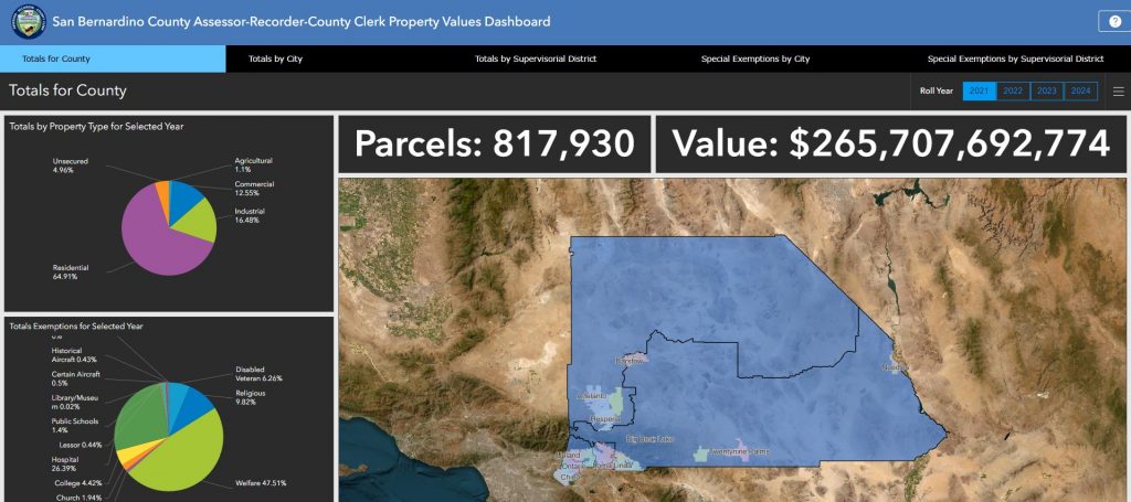
The Assessor is responsible for locating, describing, and identifying ownership of all property within the County of San Bernardino; establishing an assessed value for all properties subject to taxation; listing all assessed values on the assessment roll; and applying all legal exemptions.
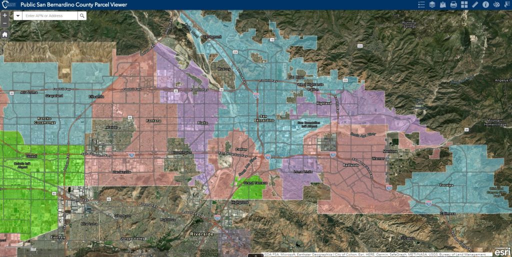
The Assessor’s Parcel Access application provides for publicly available property information searches via an interactive map of San Bernardino County. Please use Chrome or Firefox web browsers.
Please note, ARC does not provide special query services.
1978-Present Assessment Roll
View historical assessment valuations for cities and the county from 1978-Present.
Third Party Property Information Data Collection Services:
The vendors below provide property information, document search capabilities and for a fee, may process special queries and bulk data reports.
Parcel Quest Lite (PQ LITE) | Avenu | Core Logic | DataTree | Property Insight
Disclosure: The County of San Bernardino assumes no responsibility arising from use of these vendors. No warranty of any kind, expressed or implied, including but not limited to, the implied warranties of merchantability and fitness for particular purposes is made. It is the responsibility of the recipient of this data to determine that the level of accuracy meets the needs of their application prior to making any judgments or decisions based on this information.
GIS Shape File can be obtained by contacting the County of San Bernardino Innovation and Technology Department’s GIS Team.
Assessor Property Data Files
Names and address information protected per California Government Code Section 7928.205.
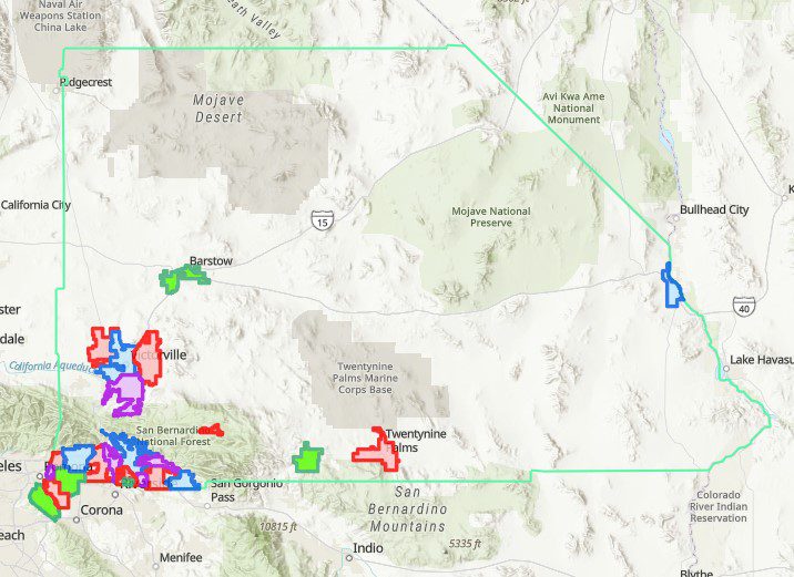
New and recently modified Parcel Maps:
June 2026
May 2026
April 2026
March 2026
February 2026
January 2026
Download Instructions
LIMITATION OF LIABILITY
Data provided by the San Bernardino County Assessor’s Office is maintained for internal use only in the determination of property value for the purpose of taxation. While the office strives to maintain the accuracy of the content of its data files, it makes no claims, promises, or guarantees about the accuracy, completeness, or adequacy of the contents of the files. The County of San Bernardino assumes no responsibility arising from use of this information. No warranty of any kind, expressed or implied, including but not limited to, the implied warranties of merchantability and fitness for particular purposes is made. It is the responsibility of the recipient of this data to determine that the level of accuracy meets the needs of their application prior to making any judgments or decisions based on this information.
The County Assessor does not determine the permitted use of property nor legal ownership of property.
The Assessor-Recorder-Clerk has no legal authority to determine permitted use of property nor legal ownership of property. The information found on this webpage is for the purpose of making fair and accurate property assessments, and is not intended to be relied upon for classifying actual permitted property use or determining legal ownership. For questions regarding permitted use, property owners should contact the city where the property is located or the Land Use Services Department for unincorporated communities. To determine current legal ownership of property, individuals should contact a real estate attorney or title company. Official Public Records can also be searched.